Image
Research & Fieldwork Reports - by date of work
The articles below record research and fieldwork undertaken by the Society. Many have not been published elsewhere. Click on the item header or the 'Read more' link to read the complete article. The articles are arranged in descending order of the work done, NOT the date of publication.
Felday Camp Survey 2012
In 2012 the Prehistoric Group undertook a survey of Felday Camp, an Iron Age enclosure with a WWI prisoner-of-war camp within.
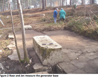
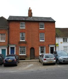
Watching brief, Old Forge, Farnham 2012
The site of The Old Forge (SU 83924 46729) lies adjacent to the corner of Upper and Middle Church Lanes in Farnham. The site is archaeologically sensitive, being close to the Parish Church and in the likely area of any Saxon settlement. The planning application for the site (WA/2011/0037) refers to ‘internal and external alterations…’ - in fact the building was demolished.
Analytic survey of prehistoric barrows on Reigate Heath 2011
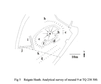
Mounds on Reigate Heath scheduled as prehistoric burial mounds, and one other potential barrow, have been subjected to analytical survey and their landscape context examined.
The attached pdf is the full report of this work of which a paper is published in the Surrey Archaeological Society Collections.
Evaluation at 45 Castle Street, Farnham, 2011
During the summer of 2011, an archaeological investigation of the garden to the rear of no 45 (SU 83894 47104) was carried out prior to the construction of an extension to the house and subsequently to monitor the footing trenches during building works.
Watching brief at 23 Castle Street, Farnham 2011-12
Watching brief by D Graham of SyAS in advance of building work. Evidence was found that the southern brick boundary wall had been built on top of and on the same alignment as a medieval ditch, which probably marked the line of the original 12th century burgage plot. The ditch had been cut by a later building, possibly 15th/16th century in date, which appeared to extend across width of the garden, and was probably contained within the curtilage of the plot.
Watching brief at Malthouse Yard Cottage, Farnham 2011
Watching brief by A Graham of SyAS. Two possible quarry pits of likely 18th/19th century date were revealed.
For more information please view the attached report
A re-survey of an outlying barrow of a group of barrows on Frensham Common, 2010
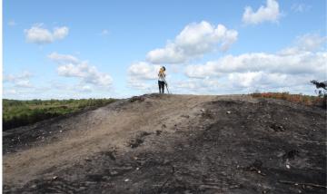
This barrow was surveyed by the RCHME in 1996 in advance of repair work, which involved raising the mound by about 60cm and laying gravel along the line of the footpath which crosses the barrow. By 2010 this gravel had worn away and this mound together with the group of three to the south, was re-surveyed by D and A Graham of SyAS at the request of English Heritage, to record the state of the monument.
Re-survey of three barrows on King's Ridge, Frensham Common, 2010
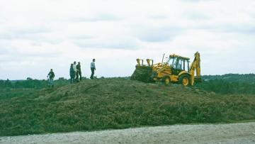
In 1996 the three barrows and the one immediately to the north were surveyed by the RCHME in advance of work to repair damage caused by horses and walkers eroding the mounds. This work involved capping the mounds, though not the southernmost one, with sand and laying gravel along the line of the paths that cross the crests of the barrows. By 2010 the gravel paths were again eroding away and the mounds being damaged by the pressure of public use of the Common.
Reigate Heath Survey 2009-10
During the winter of 2009-2010 a topographical survey of the barrow cemetery on Reigate Heath commenced. This area is centred at TQ 237504, and there are eight scheduled mounds. None of these mounds can be certainly identified as Bronze Age barrows although in the early 19th century a number of mounds were used to plant conifer clumps and finds in two of these suggested that they were burial mounds (Glover 1814). It is also possible that natural dunes and ridges of harder rock were used and the monuments cannot now be identified by above ground evidence alone.
Hascombe Hillfort Survey 2008-09
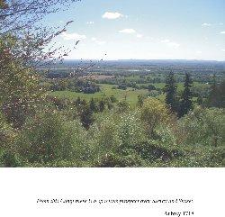
An analytical survey of Hascombe Hillfort (TQ 005 386) was carried out by members of the Surrey Archaeological Society over the winter of 2008-09, and a magnetometry survey of part of the interior took place in the spring of 2009. A full report of these activities (of which this is a summary) has been lodged in the Surrey Archaeological Society library.